Eastern Anatolia, Turkey
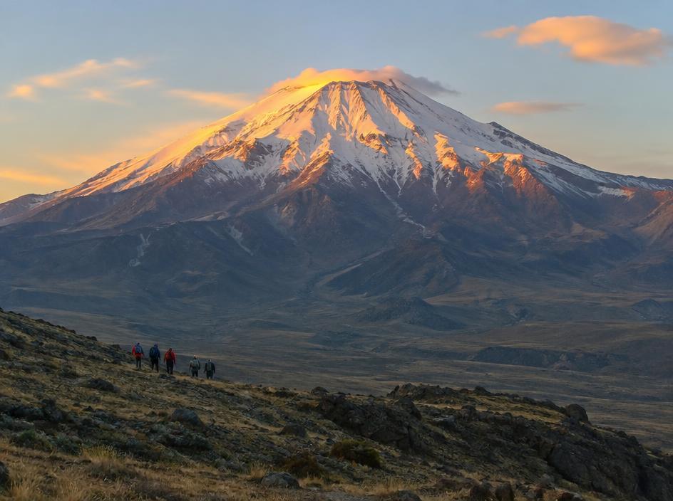
Mount Ararat Summit
Route detail
About this route
A supported ascent from Doğubayazıt with acclimatisation camps, mule support and a cold pre-dawn summit push to Turkey's highest mountain.
Daily activity
4–6 hr/day; summit day 9–11 hr.
Terrain
Volcanic scree, open highland trails, snow patches early season and high camp terrain.
Best season
June to September
Your guide office
Mount Ararat Trekking
Based in Doğubayazıt, Turkey
What's included
Local guide, permits support, transfers from Doğubayazıt, mule support, tents and mountain meals.
Not included
Flights, personal gear, travel insurance, tips.
Itinerary
- 1
Doğubayazıt briefing
Time: 2–3 hrDistance: 6 km
Meet the team, check equipment and drive toward Eli village for the first camp approach.
- 2
Base camp
Time: 4–5 hrDistance: 8 km
Mule-supported hike to base camp with a slow acclimatisation pace and mountain dinner.
- 3
High camp rotation
Time: 5–6 hrDistance: 7 km
Climb toward 4,200 m, return low to sleep and practise steady scree movement.
- 4
Move to high camp
Time: 3–4 hrDistance: 4 km
Carry only a daypack to high camp, rest early and prepare for the night start.
- 5
Summit and descent
Time: 9–11 hrDistance: 14 km
Leave before dawn for the 5,137 m summit, then descend all the way to the trailhead.
Questions about this route?
Talk to the guides who run it — gear, fitness, weather windows, private dates. We answer within one working day.
€890
per person
Local guide, permits support, transfers from Doğubayazıt, mule support, tents and mountain meals.
Next departure · Aug 27
5 of 8 spots left
Spots update as bookings come in.